 |
| The oak trees are the stars of Marshall Canyon. |
 |
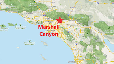
| Southern California Map. |
 |
| Driving Map. |
Trailhead coordinates: 34.15473°N, -117.7406°W.
Summary
In the foothills of the San Gabriel Mountains sits a great oak tree grove. A trail system passes through the groves to form an enjoyable loop hike. Over the years, the starting point of the hike has changed. The proper starting point is now at the end of Stephens Ranch Road in La Verne.
Hiking Stats:
 |
| Hiking Map. |
In the foothills of the San Gabriel Mountains sits a great oak tree grove. A trail system passes through the groves to form an enjoyable loop hike. Over the years, the starting point of the hike has changed. The proper starting point is now at the end of Stephens Ranch Road in La Verne.
 |
| The "Claw" tree points me in the right direction. |
To begin the loop, I turned right at the start and descended into the canyon. The trail quickly drops into the shade of the oak groves. At the bottom of the canyon, the trail meets the Marshall Canyon Equestrian Center (where the trail used to begin from). The oak groves are dense and scenic all through this area. In the rainy season, wet creek crossings are the norm.
 |
| Leaving the oaks and heading to Claremont Hills. |
The trail continues on Miller Ranch Road in a NE direction. It passes through the canyon with a gradual elevation gain. Eventually Miller Ranch Rd ends on the Claremont Hills Wilderness Park trail. I turned left and continued past the Claremont Hills Rest Station to reach Cobal Canyon Motorway.
 |
| Back into the canyon. |
I turned left and began descending back into the canyon. Perspective and views are different than on the way up. Before long, it re-enters the oak groves leading back to the parking area and completing the loop hike of Marshall Canyon.
 |
| Many chances to enjoy the oak groves along the way. |
Video:Simulated Hike:


No comments:
Post a Comment