This blog will detail 1,000 video hikes in Southern California. By Southern California, I am drawing a line from San Luis Obispo to the Nevada Border. Anything south of that line will be declared "Southern California". In a way, it is a personal challenge to do so many hikes. Mainly, however, it is my way of showcasing how many hiking opportunities there really are right in our own geographic back yard. As a blog, it serves as a companion piece to my Youtube channel "1,000 Hikes in So Cal". It is also a work in progress, as I don't actually have 1,000 edited videos completed. This will take effort for quite some time before it is declared done. Even then, there will still be more out there. Here's to hiking and all the positive effects it has had on my life...and possibly yours!
Not really much of a hiking location, being that it is in the middle of the city (and also in the middle of a memorial park), Pinkerton Hill marks a significant high point in Riverside. However, since it is undeveloped, it makes a great spot to elevate to a nice natural city viewing platform.
Cemetery Ridge.
Parking is in Olivewood Cemetery, or on nearby Dakota Avenue. The hike quickly elevates to twin peaks on a short ridge. One being Cemetery Ridge, and the higher one being Pinkerton Hill. Visiting both takes little effort, but that little effort is rewarded with great views.
Overlooking the 91 Freeway.
Admittedly, it is a little bit morbid hanging around a memorial park, but it is a nice leg stretcher when in the area.
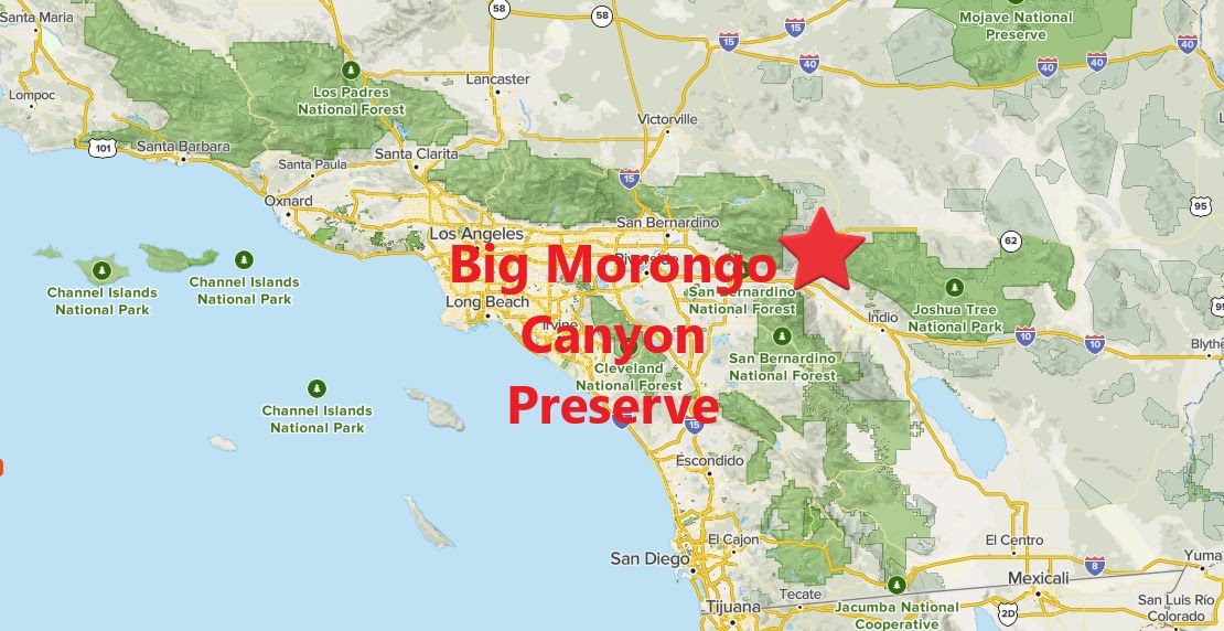
Summary Sure, you're in the desert, but Big Morongo Canyon certainly doesn't seem like it. Thanks to the Morongo Fault, there is a water source sitting out in the open. Over the years, water thriving trees and plants have grown around it and formed a lush desert jungle. After nature took care of that, pathways were built through the preserve which creates a unique desert hiking experience.
Strolling along the boardwalk.
A trail system loops around the preserve floor. An additional trail extension climbs above the preserve and gives good views down into it. In wet years, this is a very green place, with nice pools of water. In dry years, it is not usually quite as green, but still it is a great place to take a walk. This is also a great gathering spot for birds and bird watchers.
More of the same, yet it never gets old.
Behind the preserve is the rest of the canyon. The canyon is not quite as lush, but it is possible to walk through the canyon all the way to Indian Canyon Drive near Desert Hot Springs. This canyon extension to the hike may have private property restrictions, though. I was lucky enough to do it once before, but changes happen, and it is best to always be prepared to act accordingly when on site.
Summary Calling this a hike is a bit of a stretch. However, when I came across a break in the rain in the middle of the day, I had to hit a trail. The hike up Rome Hill served this purpose nicely. Since the alternative is to just sit on the couch and be inactive, this was definitely a step in the right direction.
Approaching the top.
Within the Lakeland Village section of Lake Elsinore, Rome Hill sits between the town and the lake. A short dirt road leads from the end of Gregory Pl to the top of the hill. All this really is is a leg stretcher, since it is very short. The hike could be extended, however, by continuing down the other side and over to the lake. I found out later that Rome Hill can also be reached by extending the Lake Elsinore Levee Trail and capping off the hike by climbing up the side of Rome Hill. That would definitely be a grand turnaround point and much more rewarding hiking experience. That being said, however, this shorter hike simply cuts to the chase.
Looking north from the summit.
After taking in the view and avoiding rain from the black clouds overhead, I turned this into a succinct outing, while technically claiming a peak in the process.
As far as peak climbing hikes go, this is probably one of the easiest ones that I completed. To get to the starting point, park off of Lopez Canyon Rd right at the entrance to Lopez Canyon Park. There are two vehicle gates on two dirt roads. Either one will get you to Sugarloaf, it's just that one is a better option than the other. The one to the east is the better option. A road goes straight to Sugarloaf from there.
On the summit.
The road passes below the small peak. The only real question is when to begin climbing. There is a notch on the west side that allows for a quick scramble. However, the best way to go is the walk the dirt road to the east side of the peak where a clear trail goes right up the side and onto the wide summit. The true high point wasn't obvious, so I walked the plateau from end to end and felt satisfied that I had climbed the mountain. Afterwards. I dropped down the east slope. There are good views of nearby Limerock Peak, which would make a great addition to the hiking outing on the day if willing to put in a little more effort. I paired this hike with the hike to Limerock Peak to round out the day.
After driving over 11 miles from Interstate 10 in Banning, continue south on Highway 243 to FS05, right before the Vista Grande Fire Station. I turned right on this dirt road and parked after about 100 yards or so in a large parking area. It is actually possible to drive the rest of the way to Ranger Peak with the proper vehicle, but that is better left to hiking.
On the summit.
The mostly flat hike leads to the summit of Ranger Peak. Radio towers stand tall near the high point, but on the true summit, portions of a foundation remains. I'm not sure if this was a former fire lookout or not, but distant views are really good. Returning the same way wraps up the hike with with low mileage.