This blog will detail 1,000 video hikes in Southern California. By Southern California, I am drawing a line from San Luis Obispo to the Nevada Border. Anything south of that line will be declared "Southern California". In a way, it is a personal challenge to do so many hikes. Mainly, however, it is my way of showcasing how many hiking opportunities there really are right in our own geographic back yard. As a blog, it serves as a companion piece to my Youtube channel "1,000 Hikes in So Cal". It is also a work in progress, as I don't actually have 1,000 edited videos completed. This will take effort for quite some time before it is declared done. Even then, there will still be more out there. Here's to hiking and all the positive effects it has had on my life...and possibly yours!
Having visited Bailey Canyon more than once over the years, I had developed a yearning to hike the road up to the high peaks. I had hiked it to Monument Peak years ago, and knew that if I were to hike further, the day hike would take me all day.
Peak #1: Monument Peak.
The road is rough, but is also drivable. Though, I was not willing to take my own vehicle up the road. This meant that I would need to be committed to hike nearly 20 miles to cover the ground that I had in mind.
Monument Peak summit plaque.
The historical plaque of Fr. Francisco Garces still sits on the summit like it did on my first visit.
Bailey Peak.
When the day came to carry out the plan, I was ready, willing, and eager. I set out shortly after sunrise and hiked the 5 miles to Monument Peak. It seemed almost unchanged from my visit of two decades previous. Then, as I continued along the road going west, I started covering new territory. I visited the two Bailey Peaks before eventually arriving at Sugarpine Mountain. A short but steep use trail took me to the summit, where I was able to check off my 4th Peak on the day.
Sugarpine Mountain.
With the climbs completed, all I had to do was return down Bailey Canyon. Although mostly downhill, this was no small task, since it was at least another 8 miles (my mileage counter was out of whack and inaccurate, since I was due for an IOS update on my iPhone). With minimal breaks, I managed to finish a few hours before sunset and feeling rather gratified in completing a task that I had plotted out long ago.
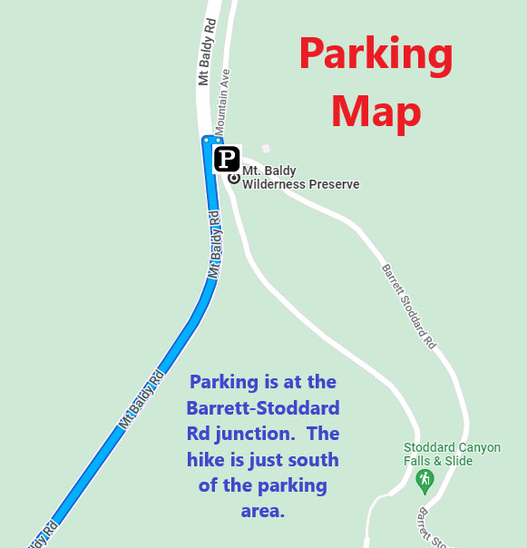
Summary Located about halfway up San Antonio Canyon, Old Mount Baldy Road is accessible from the Barrett-Stoddard Road exit from Mt Baldy Road. A small parking lot gives hikers quick access. To the tight of the parking area is the dilapidated remains of Old Mount Baldy Road.
Some of the classic guardrail posts still stand.
It hasn't been maintained for over 70 years and it looks like something out of a disaster movie. Meanwhile, the Canyon is heavily shaded. The darkly lit passageway through the canyon has a creepy feel. You never know what might jump out from behind a pile of debris!
Nature is reclaiming the road.
Some sections of pavement remains n, but for the most part the hike in s on dirt or gravel, while continuing at a slight downhill angle. Shortly after passing the Sierra Powerhouse (an operating power station), the trail narrows quite s bit in the canyon grasses.
The road continues down the canyon.
If the plan is to reach Mount Baldy Road further down, this route will get you there, but probably with a fair amount if bushwhacking. Instead, I turned around and headed back, while admiring the creek in a few sports. There is s small waterfall to visit below the road as well, which adds some site interest to the hiking experience.
Oak Canyon survives as an oasis of wilderness surrounded by neighborhoods. It is located in a small canyon in Anaheim Hills. Despite the close proximity, the canyon high in the hills is well secluded from the nearby cityscape. It really feels like a remote place without actually being one. That is the appeal to me that keeps bringing me back.
On the canyon floor.
From the parking lot, the trail begins. It leads past a visitor center and breaks off in two different directions. The left fork goes uphill and passes through some displays. The right fork enters the canyon floor. However, each option eventually meets at some point, since it is basically a loop hike that encompasses the canyon. I chose to go left first, since it gains most of the hike's elevation right away, making much of the rest of the hike and enjoyable stroll.
A creek crossing.
Most of the displays are passed in the first quarter-mile before closely reaching the top of the canyon walls. From there, the homes along the edge of the rim are visible. The trail continues below the rim on Roadrunner Ridge before dropping to the canyon road. The road leads back to the canyon floor near the visitor center in a straight line. To add variety, I picked up the Stream Trail, which parallels the creek. It is rather scenic along the creek and exemplifies the remote feel the area gives. The trail crosses a few scenic wooden foot bridges to get back to the canyon road.
Re-created mining site.
Form the canyon floor, I picked up Wren Way, which quickly climbs back up the western wall of the canyon and creates a mini loop back to the canyon floor just south of the visitor center. At that point, a re-created mining site is on display, which is always good for a photograph. This is a peaceful place, great for an easy hike, but with scenic qualities, making for a nice outdoor experience without all the sweating.
Summary The hike starts at Glendora Centennial Heritage Park. From the sign, I proceeded along a fence line and stepped into history. There sits a depicted 19th to 20th century citrus ranch. Included is a historic home, various small buildings, numerous smudge pots, and all kinds of period piece parts and supplies. It appears to be a site better suited for tours, but it makes a great visual start to the hike. The trail continues past the historic area and eventually connects with Elwood Avenue. A right turn connects with a trail that returns into the small pocket of wilderness in Glendora. The area traversed on the hike passes through and over hills in an area known as South Hills Wilderness.
Peak 1212.
The trail going in is a wide dirt road with some shade (Alosta Canyon Trail). Instead of following the dirt road all the way in (which is still a good option), I picked up a single track trail that quickly goes up slope (South Fork Trail). The climb is steep but very quick.
The summit of Peak 1212.
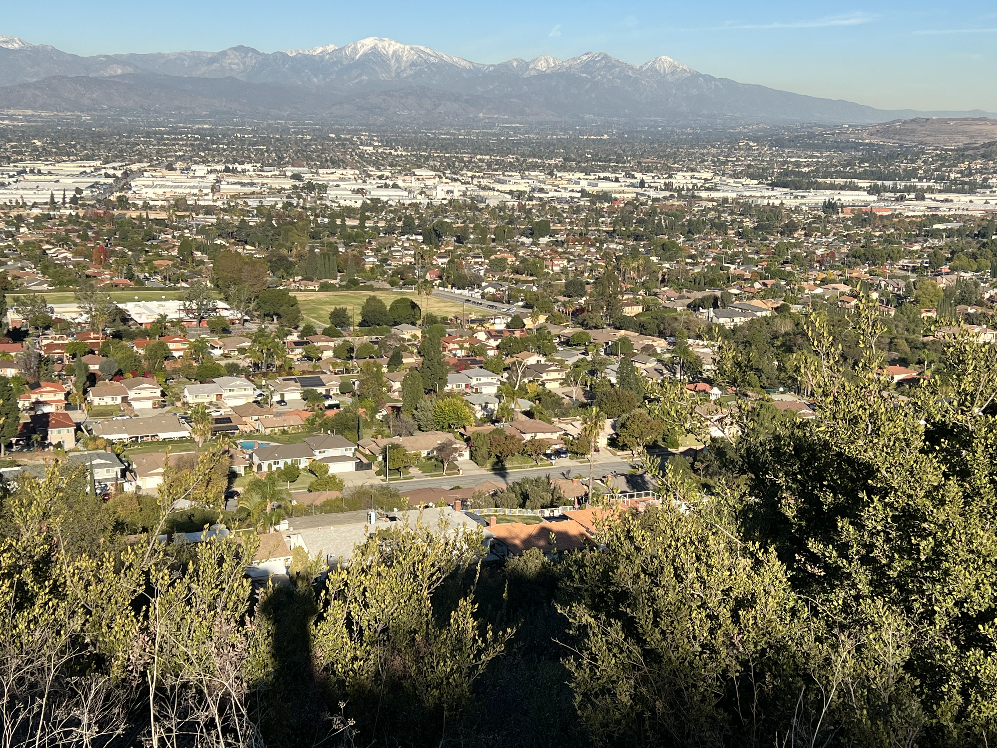
The trail meets another dirt road on the ridge (South Hills Trail). On the other side of the road, a use trail continues to the top of the highest peak in the wilderness (Peak 1212). Great city views spill out below. I picked up the continuation of the trail off the other side, which eventually met up with the South Hills Trail further down the ridge.
Summit benchmark.
While on the ridge, the hike continues in a flat and easy route toward the far edge of the hills to the west. At the western edge, The Walnut Trail passes next to a reservoir and begins descending back toward the parking lot. This is a scenic walk through a walnut grove and through some small canyons. Some other trail branch off from the Walnut Trail which offers some more variety. Though, to complete a loop of the area, I continued on to the parking lot, while wrapping up a nice wilderness hike within the city limits.
Summary The Coyote-Native Oak Loop is a hike that I generally do once a year. It is somewhat local and convenient for me to visit. I get attracted to the area every December for some unknown reason other than it feels like its the right time of year when I visit. Since Nike Hill is accessible after hiking a short section of the Schabarum Trail, I sometimes throw that in too.
Pleasant strolling.
Whether this is the best oak grove in the San Gabriel Valley is debatable. Even if it isn't, this is a great place to be. The area is just outside of a community of homes, yet there is a great deal of solitude when slipping into the groves on the slopes. Most of the climbing on the hike happens when going up the Coyote Trail. Passing under the shade of the scenic oak trees fills me with a great deal of satisfaction. The hike levels out on the Schabarum Trail, where I often continue toward Nike Hill.
A recreated check point on Nike Hill.
Nike Hill is a former Cold War missile site serving the San Gabriel Valley. Now it is a little known historical site, since it was undoubtedly a top secret site in its day. I used it as a turnaround point where I returned on the Schabarum Trail to the Native Oak Trail.
Hiking the Native Oak Trail.
The Native Oak Trail re-emerges into the oak trees and offers some of the most scenic portions of the hike. The semi-loop concludes when returning to the Ahwingna Trail and the trailhead.