Purpose of the site

This blog will detail 1,000 video hikes in Southern California. By Southern California, I am drawing a line from San Luis Obispo to the Nevada Border. Anything south of that line will be declared "Southern California". In a way, it is a personal challenge to do so many hikes. Mainly, however, it is my way of showcasing how many hiking opportunities there really are right in our own geographic back yard. As a blog, it serves as a companion piece to my Youtube channel "1,000 Hikes in So Cal". It is also a work in progress, as I don't actually have 1,000 edited videos completed. This will take effort for quite some time before it is declared done. Even then, there will still be more out there. Here's to hiking and all the positive effects it has had on my life...and possibly yours!

Showing posts with label Suburban Orange County. Show all posts

Sunday, August 14, 2022

#130 The Sycamore Hill Loop

Starting off in Sycamore Park.

Southern California Map
Driving Map.
Overall Hiking Totals:

Hiking Map.
Parking coordinates: 33.86176°N, -117.7433°W.
Summary
From Sycamore Park in Anaheim Hills, there is some open space remaining in the form of hills overlooking the neighborhoods.  A trail system cuts across its ridge.  When reaching its far edge, I could simply return the same way.  However, I was more in the mood for covering new ground and forming a loop.  Therefore, since I set out with a goal, I was determined to forge my own route.
Approaching the Sycamore Hill use trail.
I went south through Sycamore Park, along a wooden fence-lined trail.  This merges with a trail that travels along the ridge.  Just beyond the park, a use trail branches off and quickly climbs to the summit of Sycamore Hill.  Despite being surrounded by the city, the summit area does have a bit of a secluded feel to it.  It returned to the trail and continued west along the ridge route.  At one point, it passes through a neighborhood before shadowing another near the west end.  The hike then bends north and eventually extends to Santa Ana Canyon Road.
Sycamore Hill summit.
Once on Santa Ana Canyon Road, the hike turns more into a neighborhood walk.  I followed the city sidewalks back to Sycamore Park in rather peaceful neighborhoods.  Once back in the park, I completed a nice three mile urban hike.
A neighboring hill with the trail passing beneath it.
Video:
Simulated Hike:


Saturday, July 2, 2022

#126 Easy Hiking in Dana Point

Overlooking the marina.
Southern California Map.
Dana Point Map.
Parking coordinates: 33.4672°N, -117.6981°W.
Hiking Stats:
Summary
Dana Point is not a typical destination for serious hikers.  But then again, what's the point in being so serious?  Dana Point is a great place to enjoy the outdoors, and there are a few really short hikes.  On my visit, I gathered 4 different locations to formulate a hiking plan.  Each of these four were combined into a decent half day of hiking and/or travel to and from each location.  

#1: Hilltop Park
Starting the day on a staircase.

Viewing the marina from high up.
Rather than proclaiming it a hike, it is more of an urban walk.  It climbs a staircase toward a hemmed in bluff trail leading to overlooks.  In total, it is 0.5 miles out and back with a 79 foot gain.
Hilltop Park Driving & Hiking Map
#2: Bluff Top Trail
About as manicured as a walk can get.
Dana Point has a bit of history.
As walks go, I recommend this one to anybody. Walking among the expensive homes with a view feels like a privilege  to be there.  Round trip, the walk is 0.3 miles with a 45 foot gain.
Bluff Top Trail Driving & Hiking Map.
#3: Dana Point Preserve
The hemmed in trail kept me off the native plants.

Good coastal views from the bluffs.
This hike had a controlled entry point, where volunteers made sure that you brushed your shoes to eliminate non-native plant material on your shoes.  OK, no big deal.  Of the four trails mentioned, this one was definitely the busiest.  1 mile out and back with 145' of elevation gain.

#4: South Strand Conservation Park
Descending to the beach.
The trail ends at the water, unless you want to walk the beach too.
The last trail is conveniently close to Dana Point Preserve.  In fact, I didn't even need to move my car.  I descended to the beach to wrap up my quick hiking visit to Dana Point.  0.5 miles and 157' of elevation gain.
Video:

#125 The Flagpole Hill Loop

Clearly, this was Flagpole Hill.

Southern California Map.

Driving Map.
Parking coordinates: 33.48027°N, -117.6555°W.
Hiking Stats:
Hiking Map.
Summary
With coastal Southern Orange County not being well-known as a hotbed for hiking, there are still open spaces worthy of a visit. Flagpole Hill is one of them. I was able to form a loop hike out of it, which helped to add to it's appeal for video production.
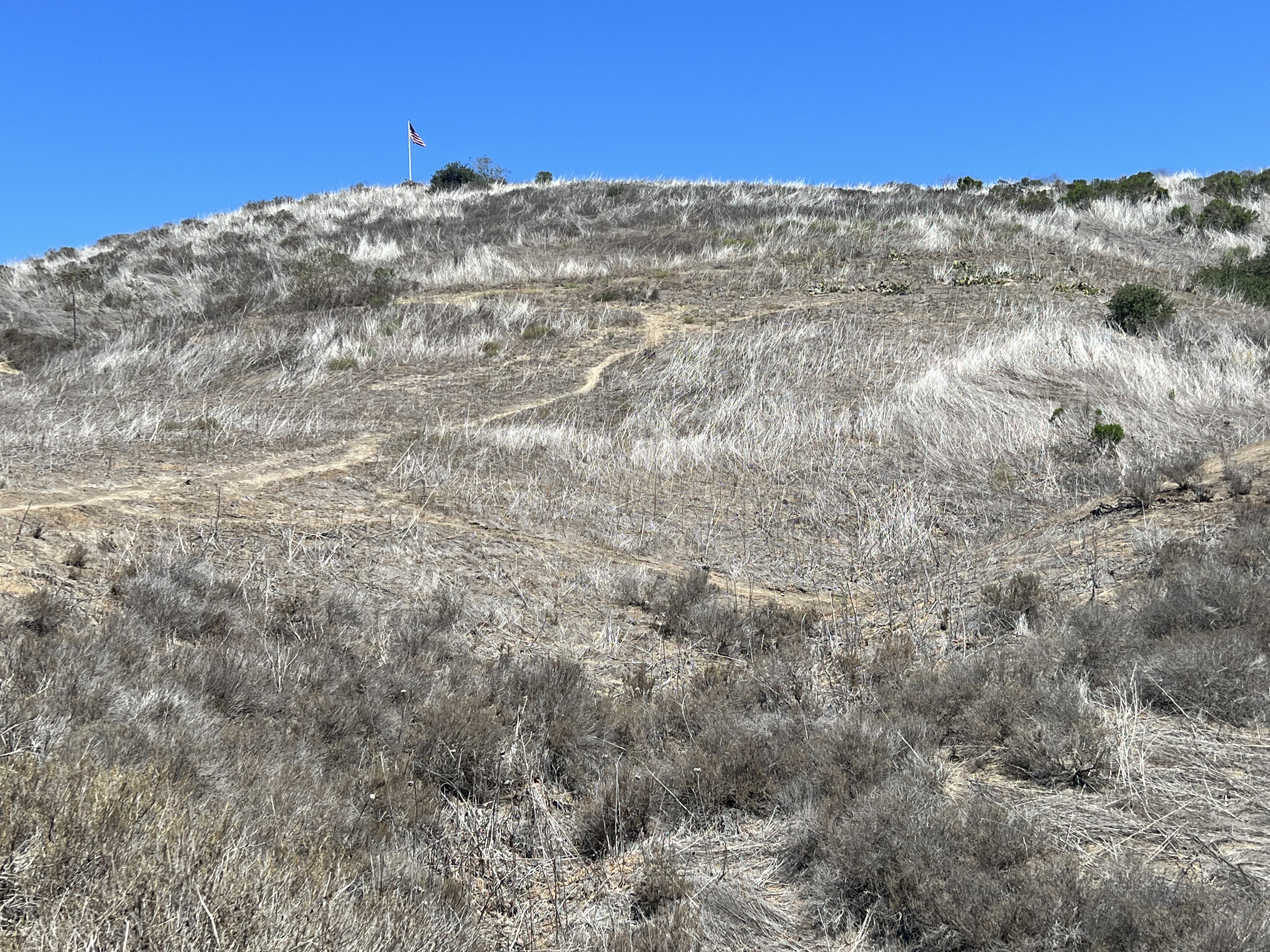
Looking up the ridge, where the flag blows in the wind.
From a San Juan Capistrano neighborhood, I entered the open spaces and made a quick left to ascend toward Flagpole Hill. The summit has a tall flag pole on top, thus the name. It is so so known as Patrick's Hill.
On top of Flagpole Hill.
The summit is the hike high point, but the trail continues in a half circle along the ridge, where it crosses over a lower Hill before ending on a third high point, Peak 880.
Heading off on the ridge to visit the other high points.
I then dropped back to a five point junction where I return to the parking area through the Canyon. I combined this with a visit to Dana Point, where I was able to gather a handful of other easy hikes. 
A bench with a view on Peak 880.
Video:
Simulated Hike:

Saturday, April 23, 2022

#107 Peters Canyon Regional Park

Overlooking Peters Canyon Reservoir.

Southern California Map.
Driving Map.
Parking coordinates: 33.7825°N, -117.7626°W.

Hiking Stats:
Hiking Map.
Summary
Peters Canyon Regional Park is an example of some wild open space preserved from the encroaching urbanization. It has been surrounded now by several decades, but still manages to serve as a decent outdoor destination.  The park features a reservoir and some rolling hills on a narrow greenbelt section of land. 
Heading up to the park high point.
Conveniently, a trail forms a loop through the open spaces, making for a good half day hike without the need to travel great distances by car (depending on where you live, of course).  To make a full day of the experience, I combined this with a visit to Irvine Regional Park, which is right down the road.
On the high point.

Due to accessibility to the nearby urban areas, the trails get pretty busy here, especially on weekends.  I had to use quite a bit of timing opportunities in order to shoot video footage at certain times after crowds dispersed.  Near the southern end of the loop, the trail gets immersed in a shady eucalyptus forest.

Passing through the eucalyptus grove.
Inside of it is very peaceful and a pleasure to experience for a short time.  Afterwards, the hike back to the start is mostly unshaded while skirting the edge of the park and nearby homes.  However, still maintaining the wild open space feel along the way.  It felt good to venture out here for the day, although not being too far away from civilization.
A chance to slow down before leaving the park behind.
Video:

Simulated Hike:


#159 Guatay Mountain

Looking up the side of the mountain. Southern California Map. Driving Map. Overall Hiking Totals: Hiking Map. Google Maps Trailhead Link Par...