This blog will detail 1,000 video hikes in Southern California. By Southern California, I am drawing a line from San Luis Obispo to the Nevada Border. Anything south of that line will be declared "Southern California". In a way, it is a personal challenge to do so many hikes. Mainly, however, it is my way of showcasing how many hiking opportunities there really are right in our own geographic back yard. As a blog, it serves as a companion piece to my Youtube channel "1,000 Hikes in So Cal". It is also a work in progress, as I don't actually have 1,000 edited videos completed. This will take effort for quite some time before it is declared done. Even then, there will still be more out there. Here's to hiking and all the positive effects it has had on my life...and possibly yours!
After starting out the day at Pachappa Hill, I continued to northern Riverside at the NW side of Sugarloaf Mountain. I began from an industrial complex parking lot on the NW side off Marlborough Avenue (availability to park in this area is limited and may now be off limits). Parking often takes research, and researching a different place to park may be necessary going forward.
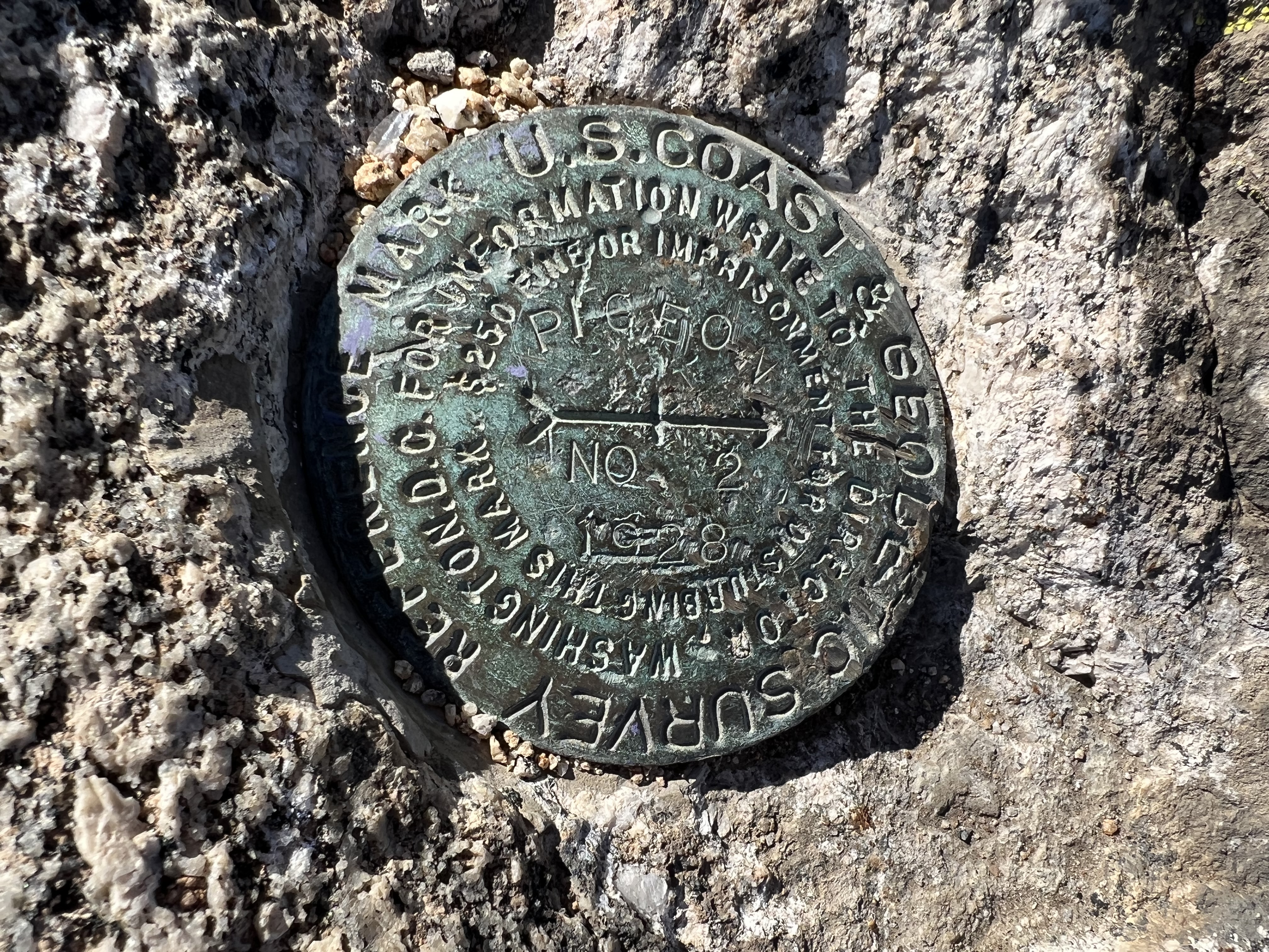
Pigeon Benchmark.
Construction was getting started in this area north of the peaks, and may now be off limits. However, from the parking area, I followed a dirt road about a half mile to a use trail leading up to a saddle between Pigeon Benchmark and Sugarloaf Mountain. A gradual climb leads to the saddle. A right turn completes the easy walk to Pigeon Benchmark. The actual benchmark sits on a summit boulder.
Sugarloaf Mountain from the saddle.
Turning back around, Sugarloaf Mountain stands tall behind the saddle. I hiked back to the saddle and continued on a use trail around the south side. I looked for a use trail going up around that side. Eventually, I found it and completed the short but steep climb up Sugarloaf Mountain. On top there are great views, as expected. Also, there is a makeshift memorial for a fallen local person.
Winter and the rainy season makes it look like the Scottish Highlands.
From the summit, I continued down the opposite slope on the continuation of the use trail. It descends steeply to the dirt road back on level ground. A left turn leads back to the parking area and a continuation of a rewarding loop hike of two peaks in the Inland Empire.


No comments:
Post a Comment