 |
| Overlooking the marina. |

 |
| Southern California Map. |
 |
| Dana Point Map. |
Parking coordinates: 33.4672°N, -117.6981°W.
Hiking Stats: Summary
Dana Point is not a typical destination for serious hikers. But then again, what's the point in being so serious? Dana Point is a great place to enjoy the outdoors, and there are a few really short hikes. On my visit, I gathered 4 different locations to formulate a hiking plan. Each of these four were combined into a decent half day of hiking and/or travel to and from each location.
#1: Hilltop Park
Rather than proclaiming it a hike, it is more of an urban walk. It climbs a staircase toward a hemmed in bluff trail leading to overlooks. In total, it is 0.5 miles out and back with a 79 foot gain.
#2: Bluff Top Trail
As walks go, I recommend this one to anybody. Walking among the expensive homes with a view feels like a privilege to be there. Round trip, the walk is 0.3 miles with a 45 foot gain.
#3: Dana Point Preserve
This hike had a controlled entry point, where volunteers made sure that you brushed your shoes to eliminate non-native plant material on your shoes. OK, no big deal. Of the four trails mentioned, this one was definitely the busiest. 1 mile out and back with 145' of elevation gain.
 #4: South Strand Conservation Park
The last trail is conveniently close to Dana Point Preserve. In fact, I didn't even need to move my car. I descended to the beach to wrap up my quick hiking visit to Dana Point. 0.5 miles and 157' of elevation gain.
 |
| Starting the day on a staircase. |
 |
| Viewing the marina from high up. |
 |
| Hilltop Park Driving & Hiking Map |
 |
| About as manicured as a walk can get. |
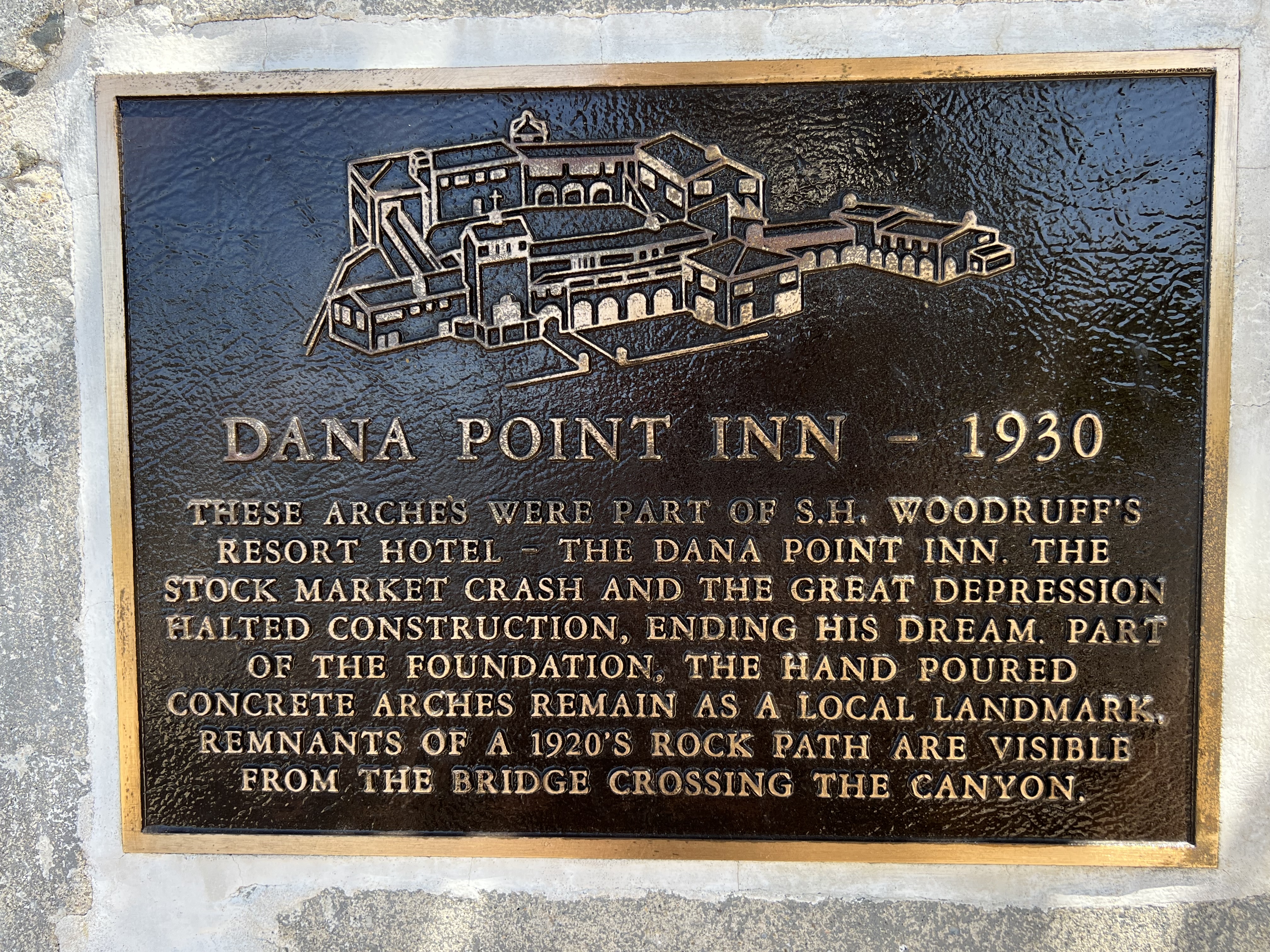 |
| Dana Point has a bit of history. |
 |
| Bluff Top Trail Driving & Hiking Map. |
 |
| The hemmed in trail kept me off the native plants. |
 |
| Good coastal views from the bluffs. |

 |
| Descending to the beach. |
 |
| The trail ends at the water, unless you want to walk the beach too. |
Video:


No comments:
Post a Comment