 |
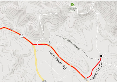
| Parking Map |
Parking is 8.7 miles south of Interstate 10.
Trailhead coordinates: 33.87927°N, -116.83273°W.
Peakery Link: Barker Peak, 4,334 ft.
Summary
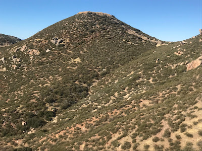
Several peaks tower over the city of Banning. One in particular (Barker Peak) is reachable after a drive up Highway 243. To reach the hiking starting point, I drove 8 miles south of Interstate 10 to Twin Pines Road. From there it is a short drive to Valley Hi Drive on the left. The road may not be signed, but it is a dirt road passing through ranch properties toward Barker Peak. To reach the hiking starting point, it is best to find a place to park as the road gets rough.
The dirt road starts heading uphill. There is one wide bend in the road, creating a bit of a switchback. It is pretty much a straight shot from there. On top is the cement foundation of a former lookout tower. Great views below, which is the true hallmark of a good lookout site. As a recommendation, pairing this hike with nearby Ranger Peak will knock off two mountain conquests within a few hours.
Simulated Hike:


No comments:
Post a Comment