 |
| The trailhead looks a bit like the Australian Outback. |

 |
| Southern California Map |
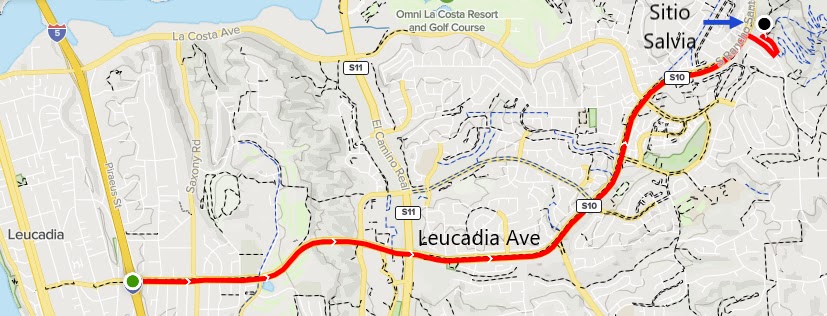 |
| Driving Map |
*Parking on Sitio Salvia is 5 miles east of Interstate 5.
Trailhead coordinates: 33.08840°N, -117.22369°W.
Peakery Link: Denk Mountain, 1,040'
Hiking Stats:

 |
| Hiking Map |
 |
| Heading up the side of the mountain. |
Summary:
The Denk Mountain Trailhead is in a residential neighborhood, which turned out to be an easement between properties. Beyond the pavement, it becomes a trail. A right turn led to a mostly non-utilized trailhead kiosk. I turned left at the kiosk and followed the trail toward the peak. Two separate trails have been worn down through the years. One is a gradual trail with switchbacks, and the other goes straight up. Since it is not a long climb, I just went straight up. The summit is wide and has nice views. On the way down, I started out on the gradual descent, but found it unnecessary right away. When I had access to the express route, I grabbed it and followed it back down to my car.
 |
| Summit views toward the ocean. |
Video:
Simulated Hike:
____________________________________________________________


No comments:
Post a Comment