 |
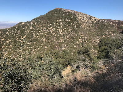
| Looking toward Fernando 2 Benchmark from May Peak. |
Santa Clarita Divide Road is a winding drive on a paved road. It leads all the way to a fire station at the base of Fernando 2 Benchmark. Santa Clara Divide Road connects with 4 peaks along the ridge, to include Contract Point, Fernando 2 Benchmark, Tribute Peak, and May Peak.
Hiking Stats (all 4 peaks):
*Parking for Contract Point is 2.7 miles from Little Tujunga Canyon Rd.
Trailhead parking coordinates: 34.345261°N, -118.407501°W.
Peakery Link: Contract Point, 3,635 ft.
Drove Santa Clarita Truck Trail to a dirt road access road for Contract Point. There is a locked vehicle gate there, so that is where the short hike begins. I walked out onto the dirt road where radio towers are spread out in different groupings. I stopped at Contract Point 2, which was a little higher than Contract Point 1 further down the dirt road by like 100 yards or more. From there, it is a slight uphill back to the parking area. Quick and easy.
*Parking for Fernando 2 Benchmark is 4.1 miles from Little Tujunga Canyon Rd.
Trailhead parking coordinates: 34.353368°N, -118.416633°W.
Peakery Link: Fernando 2 Benchmark, 4,003 ft.
Did this one the easy way. I drove Santa Clara Truck Trail past the fire station to where the road branches. I drove the left branch to a parking area just before the gate on the summit (There were even parking stalls and parking curb stops there). From there, I walked out onto the summit to visit the summit crosses. Next, I encircled the fenced in summit structures to cover all the high ground. Hard to believe, this one was probably easier than the Mesa hike that I completed a few minutes earlier. Later, when going up May Peak, I saw the steep use trail that goes up Fernando 2 Benchmark's western slope. That is obviously the more sporting way to climb the mountain. One other note, I saw no benchmark up there despite the name, but then again, I really didn't look very hard.
*Parking for May Peak is 3.8 miles from Little Tujunga Canyon Rd.
Trailhead parking coordinates: 34.353619°N, -118.412244°W.
Peakery Link: May Peak, 3,948 ft.
To begin the hike to May Peak, I parked just west of the fire station on Santa Clarita Truck Trail (Santa Clarita Divide Rd), since the road started to degrade quite a bit going forward. Since I was out to go hiking anyway, it was an easy decision to start walking from there. I followed the road west for about a mile to a saddle between May Peak and Fernando 2 Benchmark. I continued up the use trail going west. This lead to three bumps along the ridge that are about the same height. I hit all three. On the last one to the west, I found a benchmark and a summit rock pile, which appeared to mark the true summit of May Peak. On the way back, I diverted a few yards to include Tribute Peak. This was a cold and windy winter day, but there was nowhere else I would rather be on the day!
Video:Simulated Hike:


No comments:
Post a Comment