 |
| Passing through the oak trees. |
 |
| Southern California Map. |
 |
| Driving Map. |
Trailhead coordinates: 34.00951°N, -117.994°W.
Summary
The Coyote-Native Oak Loop is a hike that I generally do once a year. It is somewhat local and convenient for me to visit. I get attracted to the area every December for some unknown reason other than it feels like its the right time of year when I visit. Since Nike Hill is accessible after hiking a short section of the Schabarum Trail, I sometimes throw that in too.
Hiking Stats:
 |
| Hiking Map. |
The Coyote-Native Oak Loop is a hike that I generally do once a year. It is somewhat local and convenient for me to visit. I get attracted to the area every December for some unknown reason other than it feels like its the right time of year when I visit. Since Nike Hill is accessible after hiking a short section of the Schabarum Trail, I sometimes throw that in too.
 |
| Pleasant strolling. |
Whether this is the best oak grove in the San Gabriel Valley is debatable. Even if it isn't, this is a great place to be. The area is just outside of a community of homes, yet there is a great deal of solitude when slipping into the groves on the slopes. Most of the climbing on the hike happens when going up the Coyote Trail. Passing under the shade of the scenic oak trees fills me with a great deal of satisfaction. The hike levels out on the Schabarum Trail, where I often continue toward Nike Hill.
 |
| A recreated check point on Nike Hill. |
Nike Hill is a former Cold War missile site serving the San Gabriel Valley. Now it is a little known historical site, since it was undoubtedly a top secret site in its day. I used it as a turnaround point where I returned on the Schabarum Trail to the Native Oak Trail.
The Native Oak Trail re-emerges into the oak trees and offers some of the most scenic portions of the hike. The semi-loop concludes when returning to the Ahwingna Trail and the trailhead.
 |
| Hiking the Native Oak Trail. |
 |
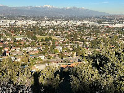
| San Gabriel Valley view. |
Video:Simulated Hike:


No comments:
Post a Comment