 |
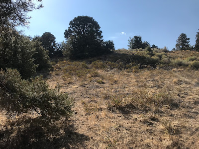
| Approaching the summit. |
 |
| Southern California Map |
 |
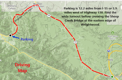
| Driving Map |
Google Maps Parking Link
Parking coordinates: 34.35725°N, -117.61268°W.
That's where I picked up a rather clear use trail which continued the climb to the top. A wide grassy summit is marked with a pile of rocks on the highest point. Good views from the summit of all the surrounding peaks (which are all higher than East Table Mountain). However, height isn't the main draw. This is a very secluded spot rarely visited by other hikers.
Video:Simulated Hike:
Hiking Stats:
 |
| Hiking Map |
Summary
To the east of Wrightwood on Angeles Crest Highway, there is the Sheep Creek Bridge. To the east of the bridge is a wide pullout right at the southeast slope of East Table Mountain. Cross the creek bed here and look for a use trail going right up the slope. The trail was relatively straightforward on my visit, with no bushwhacking necessary. It connects with a road which continues going up. It continues to an area a little below the summit. At this point, the road bends to the right and goes away from the high point.  |
| Getting close to the high point. |
 |
| On the summit. |


No comments:
Post a Comment